The Great Flood of 1993—Photos
Mississippi River Flood of 1993—On August 1, 1993, the largest peak discharge since 1844 was measured at St. Louis on the Mississippi River by the U.S. Geological Survey.
Mark Twain— "The Mississippi River will always have its own way, no engineering skill can persuade it to do otherwise... "Mark Twain in Eruption."
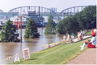
 Governor Carnahan Interviewed—Governor Mel Carnahan, seated on the right, gives an interview to the news media during the 1993 flood at the Jefferson National Expansion Memorial (Arch).
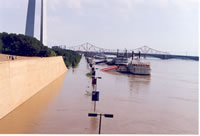 Mississippi River at St. Louis—Mississippi River at St. Louis near the Jefferson National Expansion Memorial (Arch).
 Mississippi River at the Jefferson National Expansion Memorial—A view of the Mississippi River and Laclede's Landing near the steps of the Jefferson National Expansion Memorial (Arch).
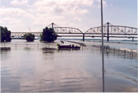 Mississippi River at Alton, Illinois—The 1993 flood south of the Missouri Highway 367 bridge near Alton. A USGS gaging station was inundated near the fence.
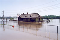 Missouri River at St. Charles—The Missouri River floods the railroad station at St. Charles, Missouri.
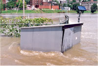
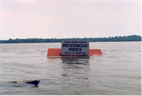 Riverboat Rides?—Many businesses were closed during the flood.
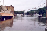 Town of Grafton, Illinois—Many communities along the Mississippi River were flooded.
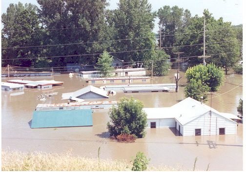 Homes and Businesses—At Least 70 towns were completely inundated.
 Gaging Station at Mississippi River at Grafton—The gaging station known as Mississippi River at Grafton was submerged and had to be moved to higher ground as a temporary solution.
 Flooded Gaging Station—A Hydrologic Technician moves equipment out of a flooded gaging station.
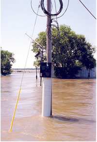 Temporary Gaging Station—Gaging stations were moved to telephone poles for temporary locations to stay above the high water.
 Effects
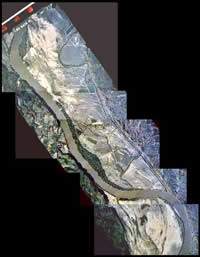
on the Columbia/Eagle Bluffs Wetland Complex—The flood water was approximately
12 feet deep over most of the floodplain during the peak of the 1993 Flood.
Effects
on the Columbia/Eagle Bluffs Wetland Complex—The flood water was approximately
12 feet deep over most of the floodplain during the peak of the 1993 Flood.